Immersive or Analytical Flight
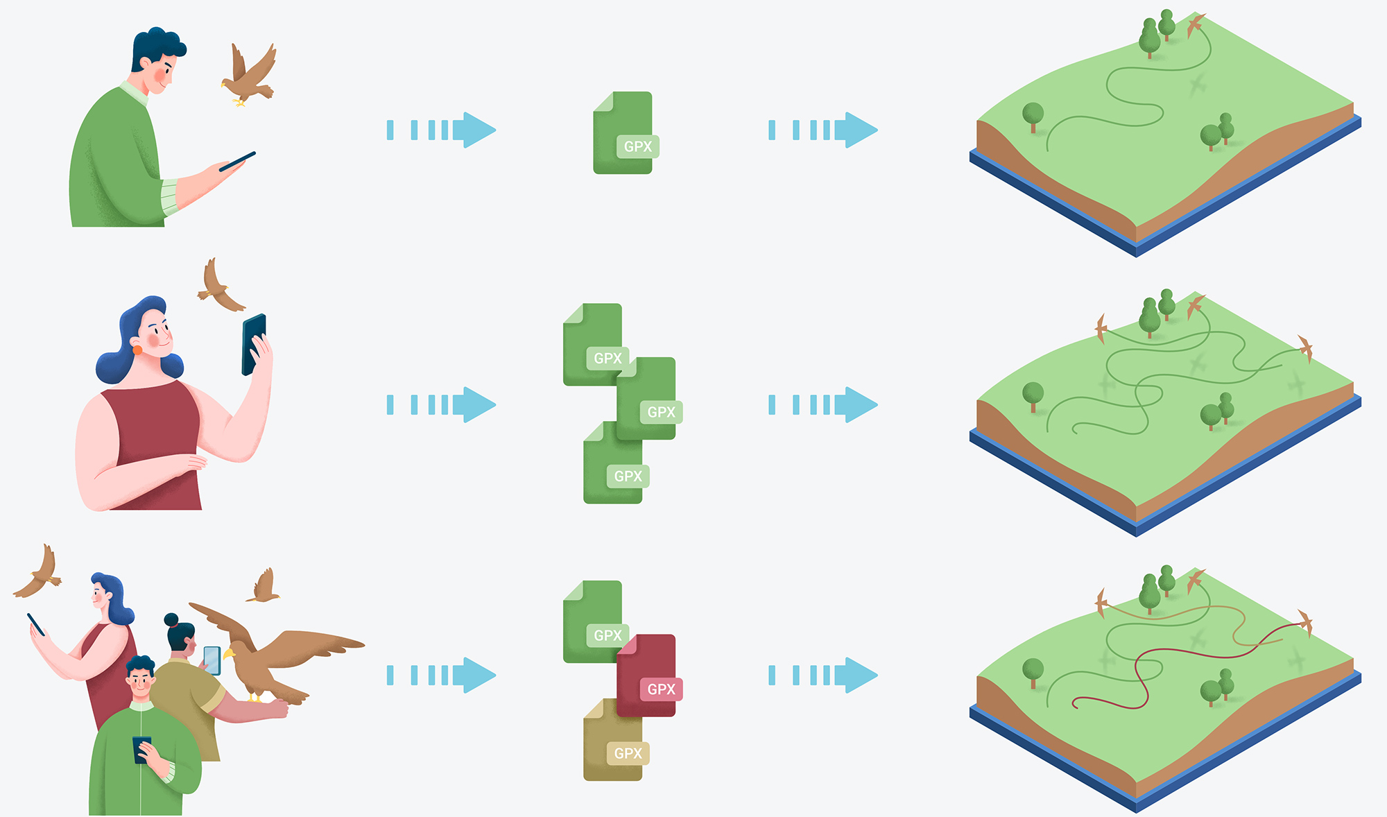
Want to understand what happens to your birds? Submit your tracks in GPX format or others, we will process these files to give you an accurate representation of the flights."
Are you a scientist, researcher, or conservation program manager? With BirdTracking, add your data to the platform to access a new dimension of the flights you've collected.
The 3D projection will reveal behaviors and trajectories that will help you better understand the choices made by the birds being studied.
Gather multiple specimens on the same plane in just a few moments.
BirdTracking is an online tool for tracking birds and other data collected by sensors on animals. We help researchers, conservation program managers, enthusiasts, and others involved in animal tracking to manage, analyze, archive, and share their data in 2D or 3D. Users can use BirdTracking to share their animal tracking data with the public or with other subscribers on our platform.
The data remains strictly confidential, and no file can be shared without your personal approval.
To benefit from our services, start by signing up for free on our platform.
The visualization tool is easy to master, and the quality of the rendering will help you better appreciate and understand certain trajectory choices made by your birds.
Many statistics are offered, allowing you to quickly understand the effort or quality of the flight performed by the bird.
Many map bases are available to help you better understand and navigate the flights submitted to the servers.
Obtain the vital zone, hunting territory, or roosting areas of your birds by uploading files spanning several weeks to several years.
The 3D engine we provide is a software component that creates raster images from your GPX files' three-dimensional coordinates. The rendering quality is equivalent to that of the gaming and simulation industry, but this tool is specifically at your disposal for your studies.
With BirdTracking, you have complete archiving of your analyses from your profile page. Your data is archived and immediately available with a simple click search.
For the first time, BirdTracking makes the invisible visible in bird tracking.
With the tools provided, you can include multiple birds in the same scene, meaning you can upload multiple files simultaneously for the same scene. Thus, 3D visualization of multiple birds becomes possible.
If multiple researchers are studying different birds with separate user accounts but within the same geographic area, grouping the birds in the 3D representation is also possible!